Land Area Mapping
Accurately measure land area using satellite and GPS technology. Get precise measurements in multiple units within minutes.
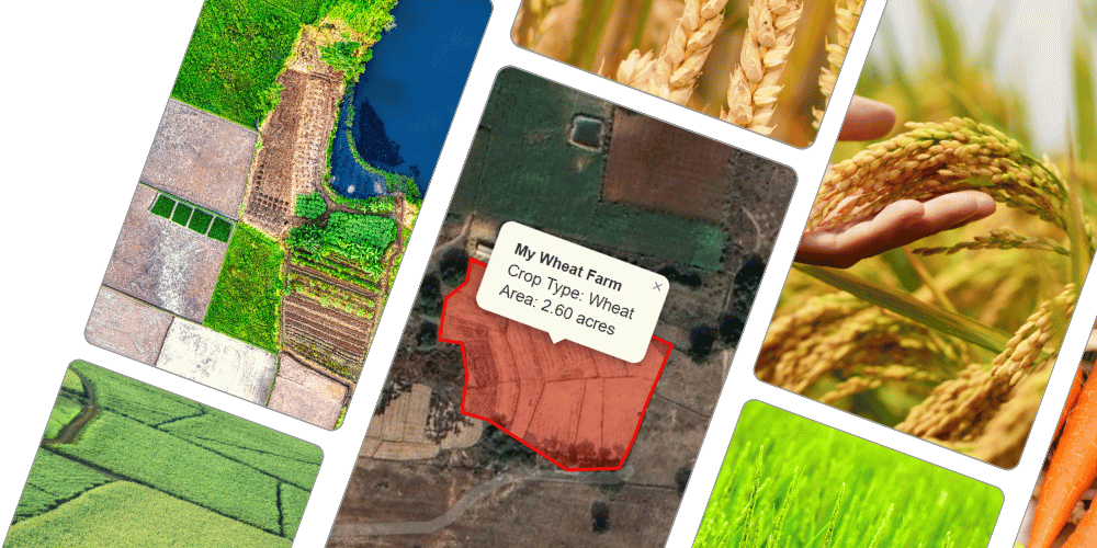
How the Service Works
KisanSAT is an advanced satellite-based land measurement service that accurately calculates land area in various local units such as Bigha, Guntha, Acre, or Hectare. By utilizing satellite imagery and GPS technology, KisanSAT ensures precise measurements of land dimensions within minutes.
The service employs high-resolution satellite data and geospatial analysis to map land boundaries accurately. Farmers or landowners can access this service through a mobile application, where they can input location details to receive instant area calculations.
Benefits of the Service
Accurate Land Measurement: Eliminates human errors common in traditional land measurement methods.
Time-Saving: Provides quick results within minutes, reducing manual survey time.
Ease of Use: Farmers can measure land using a mobile app without needing professional surveyors.
Multiple Unit Conversion: Measure land in various units like Bigha, Guntha, Acre, or Hectare.
Cost-Effective: Reduces the need for expensive land survey services.
Data Accessibility: Provides digital records useful for legal documentation and agricultural planning.
Procedure to Use
Access the Platform: Visit the KisanSAT website or download the mobile application.
Enter Land Details: Input location details or select the land area on the digital map.
Satellite Data Processing: The system analyzes satellite imagery and geospatial data to calculate land area.
Measurement Display: The land area is displayed in the chosen measurement unit.
Save and Share: Users can save the measurement report for future reference or share it for documentation purposes.